Newsletter
Join the Community
Subscribe to our newsletter for the latest news and updates
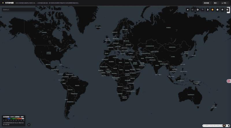
Interactive map to find dark sky locations and check light pollution levels anywhere on Earth using real satellite data (VIIRS) and the Bortle Scale.
Submit your own product to reach creators and founders looking for the next tool to try.
Light Pollution Map is a free, interactive web app built for astronomers, astrophotographers, and anyone who wants to escape city glow and see a truly dark sky. Instead of guessing where the nearest dark-sky location might be, you can open the map, click anywhere on Earth, and instantly see how much artificial light is washing out the stars there.
Key features:
Who it's for: The tool is aimed at amateur and professional astronomers, astrophotographers planning a shoot, campers and road-trippers looking for a night sky worth watching, and anyone curious about how much light pollution affects their own backyard. It's completely free to use, works right in the browser with no signup required, and is a handy companion for planning a stargazing trip, an astrophotography session, or simply finding the darkest sky within driving distance.
Website: https://www.lightpollutionmap.io/